Snaefellsnes Peninsula (Icelandic: Snæfellsnes) is like a miniature version of Iceland, displaying all the characteristic natural wonders at once: Volcanoes, lava fields, mountains of different colors, glacier, black and whiter beaches, waterfalls, and the Atlantic Ocean.
A round trip around the peninsula is a great experience on its own, but some attractions are certainly worth exploring more closely. There are many services available, such as glacier tours, horseback riding or walking inside a lava tube, 35 meters underground.
Please note that this guide has been written in 2017, so some of the information might not be correct anymore.
Popular sights in Snaefellsnes
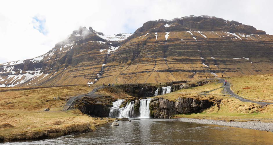
Kirkjufellsfoss and Kirkjufell Mountain
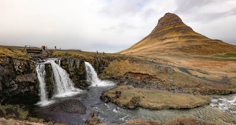
This is one of the most photographed sceneries in Iceland. It’s easy to get to and there’s a parking lot right by the road. The waterfall is just a few-minute walk away.
The mountain Kirkjufell offers great views from different perspectives, also from Grundarfjörður, a town located right next to it. Grundarfjörður is a popular place to spend the night among photographers.
Driving instructions: If you’re approaching from the east, drive through Grundarfjörður and you’ll soon see the Kirkjufellsfoss parking lot on your left and the mountain on your right. If you’re approaching from the west (road 54), you’ll first see the mountain on your left and soon thereafter the parking lot and the waterfall on your right.
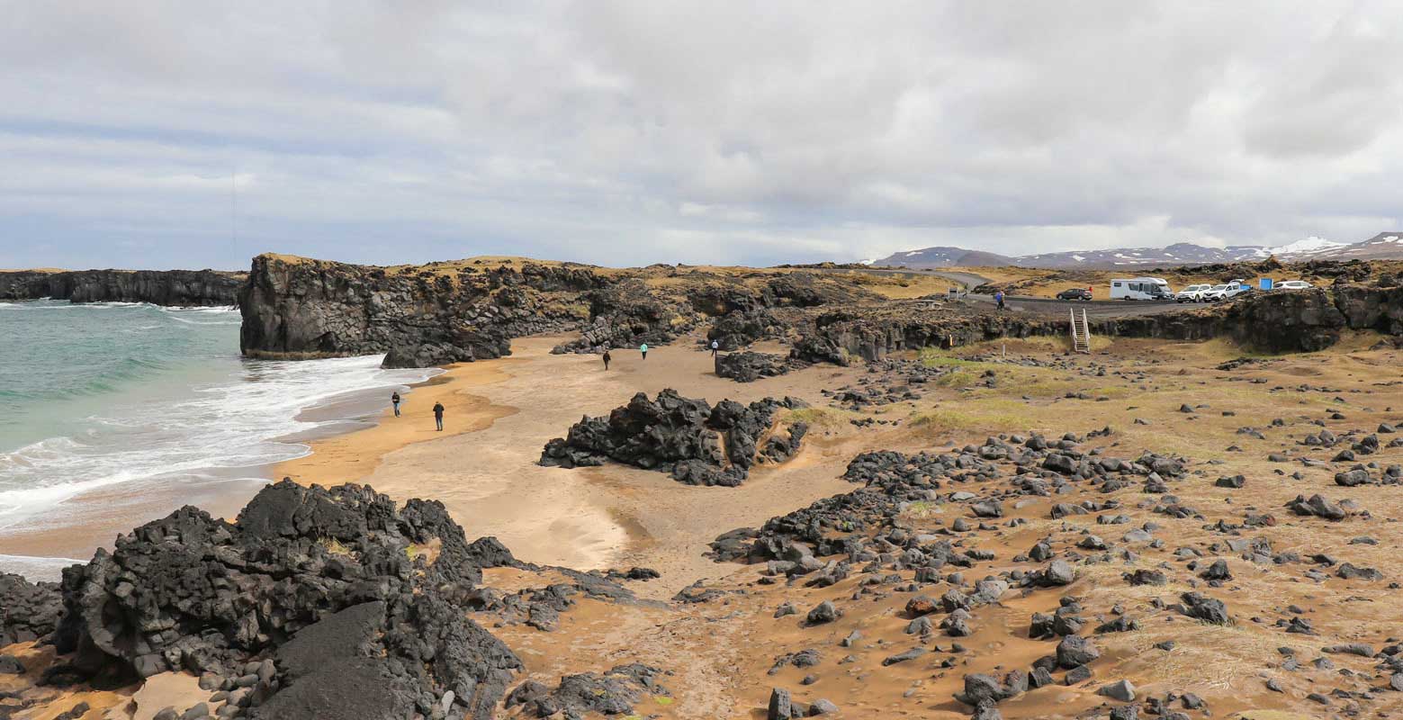
Skarðsvík Beach
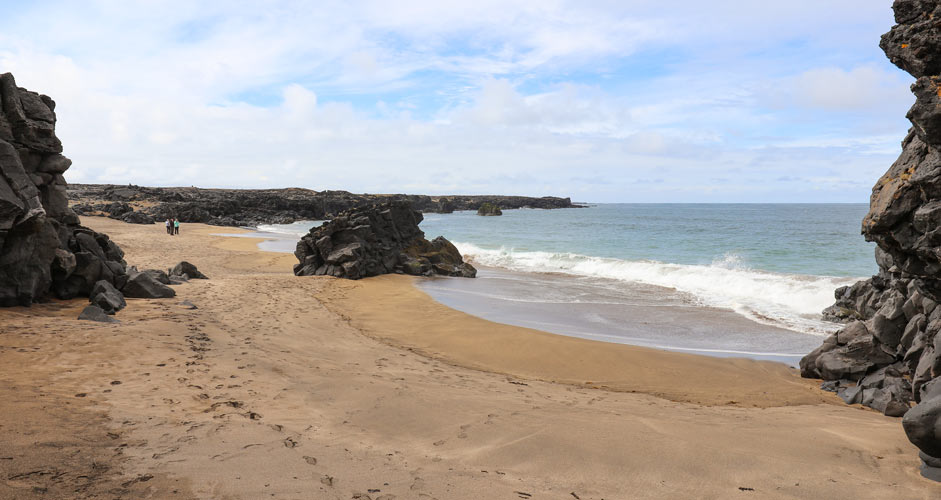
The beaches are usually black in Iceland, but Skarðsvík Beach is one of the exceptions. It is a nice desolate beach amongst black lava rocks. There are no services available.
Driving instructions: You can park your car right by the beach, as shown in this picture. The parking lot is about two kilometers away from the main road (Útnesvegur). The junction is shown in this Google Maps picture. “Öndverðarnes” in the signpost refers to a lighthouse at the end of the road, but the beach is much closer. The road is paved and in good condition, but it’s narrow so watch out for the cars coming back.
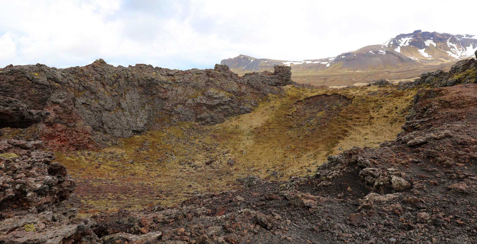
Saxhólar Crater
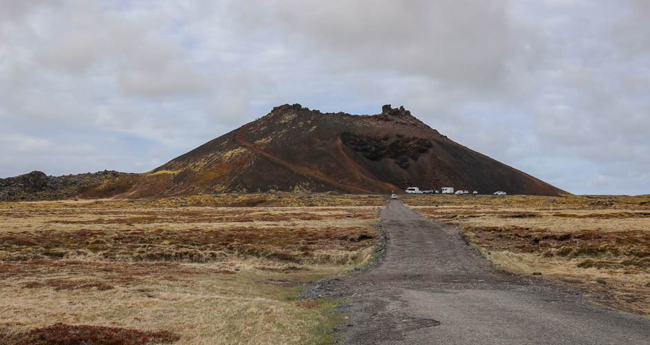
The Saxhólar Crater is clearly visible from the road (Útnesvegur) and thus easy to find. The road to the foot of the crater is short but in poor shape, so drive slowly. There's a parking lot and nice iron stairs to the top, but it takes some time and effort to climb there.
The crater looks impressive from the road, but in the end it's a hole with grass growing inside. If you are going to visit or have visited the Kerið crater in the Golden Circle, you can might as well skip this one.
Djúpalónssandur
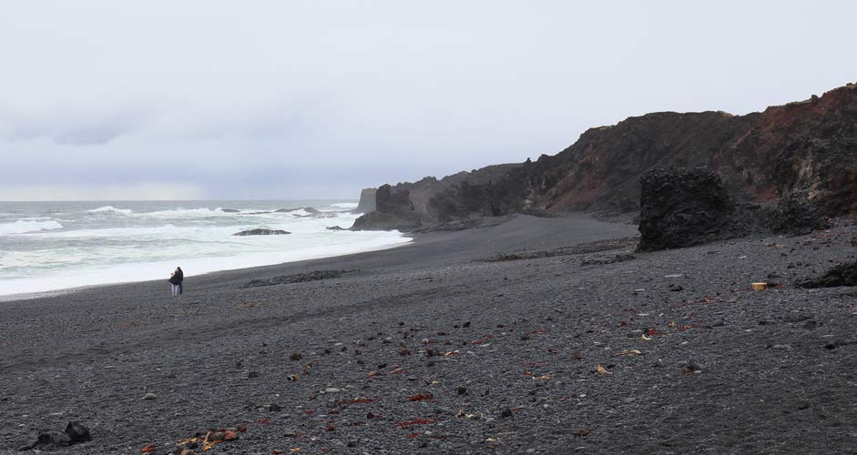
The black rocks and black beach(es) look very impressive. There’s a viewing point close to the parking lot, but you can of course walk to the beach or to the surrounding cliffs. Just watch out for the surprising and powerful waves, if you’re walking close to the water.
There are rusty parts of an old shipwreck on the beach as well as four lifting stones that were used to test the strength of the fishermen.
At the parking lot, there are signs to Dritvík (1 km), Malariff (6 km) and Einarslón (1.2 km).
- Dritvík was once the largest spring fishing station in Iceland. Today, it is similar to Djúpalónssandur with rocks and black beach beautifully on display, as shown in this picture. There are nice views on the way.
- Close to the next attraction, Londrangar, there’s a beautiful lighthouse, Malarrif.
- Einarslón is located Between Malarrif and Djúpalónssandur. In Einarslón, there are ruins of an old farm, that you may be able to spot here in Google Maps.
Driving instructions: The parking lot is about 2 kilometers from the main road, Útnesvegur. Turn to the road 572 and drive 2 km towards Djúpalón 2, as indicated in the sign. The road is paved and in good condition, but it’s narrow so watch out for the cars coming back.
Londrangar
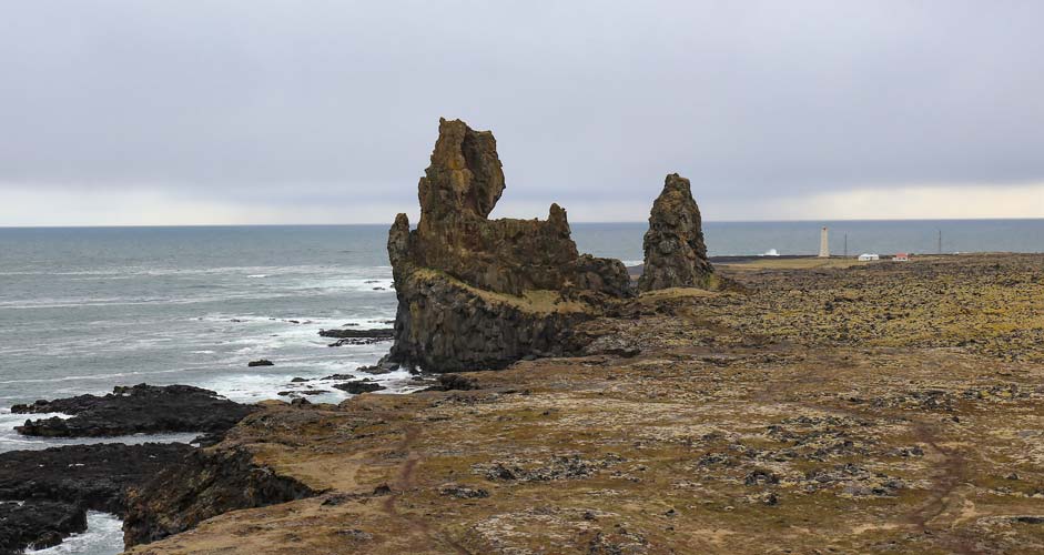
The two large rocks are a popular destination for taking photographs.
Driving instructions: They are located at the southernmost point at the tip of the Snaefellsness Peninsula. There’s a parking lot by the road, just a short walk away from a viewing point. You can see the parking lot, as well as Londrangar, in Google Street View.
Or you can drive to the Gestastofa Visitor Center next to Malariff lighthouse and walk from there along the coast and the beaches. The whole area is shown in Google Maps here.
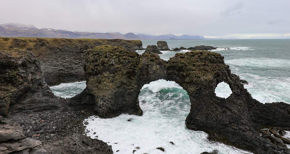
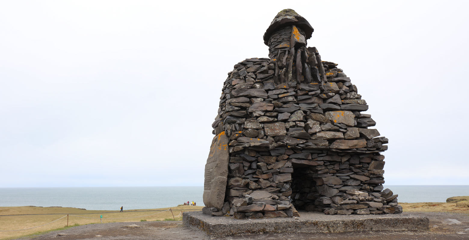
Arnarstapi
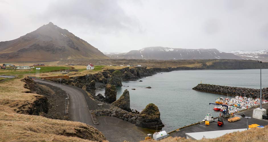
Arnarstapi is a small fishing village with a beautiful coastline between the port and the Snæfellsáss Statue. The most famous sight is the arch rock Gatklettur with a hole in the middle.
Driving instructions: Take a turn to Arnarstapavegur from the main road Útnesvegur.
You can leave the car at either of the parking lots, at the Snæfellsáss Statue or the port of Arnarstapi. The distance from the statue to the port is about one kilometer, and there's a good path by the cliffs to follow.
Satellite pictures of the area can be found in Google Maps here.
Bjarnarfoss
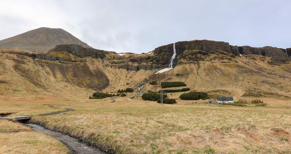
A tallish waterfall that is easy to reach.
Driving instructions: You can see Bjarnarfoss from the road 54 (Snæfellsnesvegur). It's situated close to the Útnesvegur intersection.
The parking lot is very close to the road and there's a sign with Bjarnarfoss to indicate the way. The above picture was taken from the parking lot. As shown in the picture, there's a path leading to the waterfall.
Driving to Snaefellsnes
A two-way drive between Reykjavik and the tip of the peninsula takes over six hours, so reserve the whole day or more for the trip if you’re planning to make on-site visits.
If you decide to stay longer in Snaefellsnes, there are plenty of options for accommodation in the towns around the peninsula.
At least in the summertime, a normal car will suffice to get to the coastal attractions, since the roads are in good shape and the parking lots close by. You will need a 4x4, however, if you take the F-road through Snæfellsjökull (the glacier) in the middle of the peninsula.
---
Text and images: Jussi Ryynänen


